Atoll – Map | Atoll Mapas
Atoll -Forsk | Tutoriales | Cursos | Mapas para Atoll
Saludos.
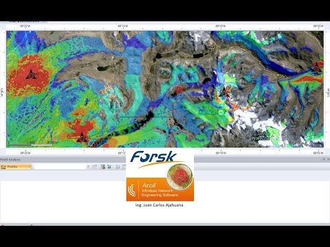
Es mi primer tutorial, de simulacion de propagacion con la herramienta ATOLL 3.3 . Donde hay poca informacion del como importar mapas con elevacion.
1.- Enlace para descargar el sector de mapa con elevacion donde se realizara la simulacion de propagacion.
http://earthexplorer.usgs.gov
2.- inserten el siguiente texto en “atoll.ini” para visualizar los mapas online de diferentes servidores.
[OnlineMaps]
Name1 = OpenStreetMap Standard Map
URL1 = http://a.tile.openstreetmap.org/%z/%x/%y.png
Name2 = MapQuest Open Aerial
URL2 = http://otile1.mqcdn.com/tiles/1.0.0/sat/%z/%x/%y.jpg
Name3 = 2Gis
URL3 = http://static.maps.api.2gis.ru/1.0?c…z&size=256,256
Name4 = 2Gis without logo
URL4 = http://tile2.maps.2gis.com/tiles?x=%x&y=%y&z=%z&v=37
Name5 = Bing Aerial
URL5 = http://ecn.t3.tiles.virtualearth.net…/a%q.jpg?g=392
Name6 = Bing Hybrid
URL6 = http://ecn.t3.tiles.virtualearth.net…/h%q.jpg?g=392
Name7 = Bing Road
URL7 = http://ecn.t3.tiles.virtualearth.net…/r%q.jpg?g=392
Name8 = Yandex Road
URL8 = http://static-maps.yandex.ru/1.x/?ll…=%z&l=map&key=
Name9 = Yandex Aerial
URL9 = http://static-maps.yandex.ru/1.x/?ll…=%z&l=sat&key=
Name10 = Yandex Hybrid
URL10 = http://static-maps.yandex.ru/1.x/?ll…l=sat,skl&key=
Name11 = ArcGIS
URL11 = http://services.arcgisonline.com/Arc…e/%z/%y/%x.png
Name12 = opencyclemap
URL12 = http://tile.opencyclemap.org/cycle/%z/%x/%y.png
Name13 = Google Terrain
URL13 = http://mt.google.com/vt/lyrs=t&hl=en&x=%x&y=%y&z=%z
Name14 = Google Map
URL14 = http://mt.google.com/vt/lyrs=m&hl=en&x=%x&y=%y&z=%z
Name15 = Google Hybrid (Map + Terrain)
URL15 = http://mt.google.com/vt/lyrs=p&hl=en&x=%x&y=%y&z=%z
Name16 = Google Hybrid (Map + Satellite)
URL16 = http://mt.google.com/vt/lyrs=y&hl=en&x=%x&y=%y&z=%z
Name17 = Google Satellite
URL17 = http://mt.google.com/vt/lyrs=m&hl=en&x=%x&y=%y&z=%z
Name18 = Google Scheme
URL18 = http://mt.google.com/vt/lyrs=h&hl=en&x=%x&y=%y&z=%z
Name19 = Google Scheme2
URL19 = http://mt.google.com/vt/lyrs=r&hl=en&x=%x&y=%y&z=%z
Name19 = 2GIS
URL19 = http://tile3.maps.2gis.com/tiles?v=4&x=%x&y=%y&z=%z
atoll logiciel


