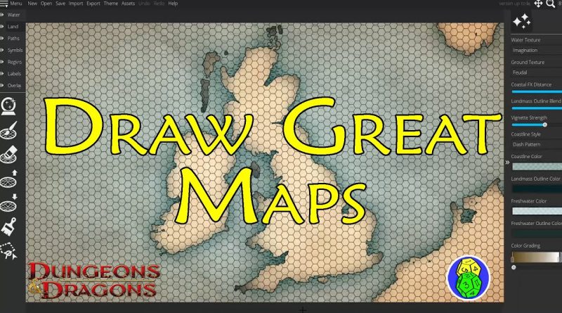
Draw Great Maps With Wonderdraft
I begin my series on the Wonderdraft mapping software program. I like Wonderdraft because it’s a one time purchase of thirty dollars, the company updates it fairly often, there are lots of third party assets available for minimum cost and it has enough features to create some great fantasy maps for your homebrewed world.
In this video I concentrate on thinking about the scale of your world map. I often go wild creating elaborate continents when using computer software, drawing whatever comes to mind before realizing that the scale of my map isn’t conducive to charting players across my world.
Even if you’re running the players in a “theater of the mind” setting where they don’t need a map, as a GM you like to know how far they’ve moved each day. Hence I put a hex grid on my maps to chart this movement, but when the scale is too large these hexes can be unworkable. But if you enlarge a map either the pixel size can become a burden or you only have a small part of your world.
I begin by showing some basics on setting up a 1920 x 1280 pixel map, then demonstrate how to create land masses quickly and with realistic detail. After quickly creating a series of land masses and islands, I note that nothing about this map tells us whether it’s on a scale of England or the whole of Europe.
I then use the trace feature in Wonderdraft to demonstrate how you can take a land mass you know, in this case the British Isles, to get a sense of scale for your own world. After recreating this map from an existing png file I scaled to 1920 x 1080, I show how the hex map is too large for effective movement/time tracking. So I use the “Create Detail Map” feature in Wonderdraft to create a large scale version of the map that has five mile hexes that are conducive to game play.
And a shout out to viewer Dave Biswas for pointing out that Great Britain includes Wales!
Check out my podcast with Daniel Norton of @BanditsKeep. We talk about D&D and being a GM and a whole lot more.
Monsters and Treasure Podcast
Apple: https://podcasts.apple.com/us/podcast/monsters-and-treasure/id1659703332
Anchor: https://anchor.fm/monsters-and-treasure
Spotify: https://open.spotify.com/show/5ATvkJKJVWgvlqQ1ZKbrd7
Here are some of the products you can use to start playing D&D and create your own homebrewed campaign.
Player’s Handbook 5e, Amazon Affiliate Website Link:
https://amzn.to/43xZaiU
Monster Manual 5e, Amazon Affiliate Website Link:
https://amzn.to/3zTjr55
Dungeon Master’s Guide 5e, Amazon Affiliate Website Link:
https://amzn.to/3o9OOpn
Tasha’s Cauldron of Everything
https://amzn.to/3zX5i6Y
Mordenkainen Presents: Monsters of the Multiverse 5e
https://amzn.to/3zTjWft
Fizban’s Treasury of Dragons 5e
https://amzn.to/3Uxfaxu
Xanathar’s Guide To Everything 5e, Amazon Affiliate Website Link:
https://amzn.to/3KrKJEs
Mordenkainen’s Tome of Foes 5e, Amazon Affiliate Website Link:
https://amzn.to/3mtGsZf
Volo’s Guide To Monsters 5e, Amazon Affiliate Website Link:
https://amzn.to/3MBpNgZ
Dungeons and Dragons 5e Core Rulebooks Gift Set, Amazon Affiliate Website Link:
https://amzn.to/3oeOu8Y
Sword Coast Adventuring Guide, Amazon Affiliate Website Link:
https://amzn.to/4085L0K
atoll logiciel


Hi! Great tutorial..I just have a question..How do you create maps as an overlay just like the UK map? Thank you!
The way you used England as a reference for scale really pushed me forward with working on my own setting. Very nifty idea!
Can you integrate this into a computer-controlled war game map counter? In other words, use this software to make a map, then use that map as the hex map with a map icon representing units.
this is what I am looking for, thank you so much
Oh by the way, if you are trying to exactly copy a map you can save a lot of time by using the "import" tool (on the upper toolbar).
This will automatically and instantly import an image file as a map (landmass and water). To work well you will want to import an image that is only black and white (not greyscale). The white areas of your imported image will come out as landmass, and the black will be your water. You can prep a map for this pretty quickly in photoshop or GIMP by selecting all your water and turning it black, and inverting the selection to turn your landmass white. 👌
"I have a map of England"
Editor's note: It's technically a map of England, Ireland & Scotland
Me a humble Welshman: 😥💔
I use the real world as reference a lot in my setting. It gives me ideas on how much space there is between settlements and what type and many natural features the players might encounter. I go to Google maps and pick a spot with a climate that matches a fictional place and steal the hills, lakes, rivers, settlements, plains, everything. I even use historical records to help me make weather more realistic. I've used it ideas on invasions, rebellions, religions, and politics. If it happened in the real world then I can use it inspire my fake world. Am excited to see what you create next week and thanks for the information on Wonderdraft. I do prefer one-time purchases to subscriptions.
Hello Mr. King, hope the moving is going well. Love seeing technology at work. I will be live and in person at my favorite game shop DMing (not anytime soon). So I will be using battle mats and probably paper and pencil, and some print outs. I need to order Dan's Blackmoor campaign (3e). CaptCorajus said out of all the material there is, that book is the most complete. I only need it for the maps, lore and basic information. I won't need to covert to 5e, no need it's all homebrew away.
Thanks Kevin you have a wonderful day!