
How We Use Seafloor Mapping Data to Guide ROV Exploration! | Nautilus Live
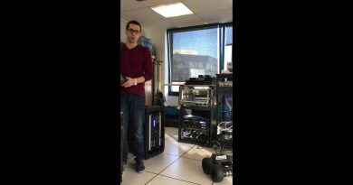
Our current expedition to #JohnstonAtoll uses the mapping information gathered on our last expedition where we were able to map 27,788 square kilometers in and around this are of the #PacificRemoteIslandsMarineNationalMonument (PRIMNM). In this video, our #CorpsofExploration explain how we gather and use that #seafloormapping data and use it to determine where to dive with #ROVHercules.
Johnston Atoll is located in the #PrimeCrustZone, an area of the #Pacific with oceanographic conditions observed to concentrate deep-sea minerals, including economically valuable metals and rare earth elements. The questions of biological connectivity are particularly relevant around Johnston Atoll as the area contains rich biodiversity and is the closest deep water marine protected area to Papahānaumokuākea Marine National Monument and in the same region as the Kingman Reef, Palmyra Atoll, and Kiribati’s Phoenix Islands Protected Area. Thanks to our mapping team, scientists on this expedition can pinpoint the best places to dive for their geological and biological research.
Learn more about this expedition funded by NOAA Ocean Exploration via the Ocean Exploration Cooperative Institute: https://nautl.us/3Hx5pZE
—
E/V Nautilus is exploring unknown regions of the ocean seeking out new discoveries in biology, geology, and archaeology. Join us 24/7 for live video from the seafloor and to ask questions of our explorers currently aboard Nautilus: www.nautiluslive.org.
Follow us on social media for dive updates, expedition highlights, and more:
Subscribe on YouTube: www.youtube.com/subscription_center?add_user=EVNautilus
Facebook: www.facebook.com/nautiluslive
Twitter: www.twitter.com/evnautilus
Instagram: www.instagram.com/nautiluslive
TikTok: @NautilusLive
atoll logiciel

WE KNOW WHAT IS REALLY UP
Hello! How can I get involved? I am an undergrad Associate of biology, wanting to continue school. However, I will be looking on the job market after this semester. This looks like an ideal opportunity, and very exciting! Let me know if/when you see this comment!
Y'all will tell us if you find aliens right?
Could the rov be put on an auto pilot type setting ? Thanks for all the work you guys are doing .
What was the name of the visualization software you said was being used? Google's Closed Captioning showed it as "inflator mouse" and my ears heard it as "trainer mouse", and I'm sure neither of those is correct.
Beautiful!
hi! i love your content and am always exited for the next videos 🙂
i was wondering if you are planning to start a podcast so we can listen to some of the explications?
thank you so much!! love your work
How does one become a marine biologist
When you are traveling or making an initial pass for the area of study, what is the width of the sonar scan please? Keep up this marvelous work! Fascinating stuff. Thank you.
Oh, that feature is seen around 6 minutes and 30 seconds
Just off to the north west of target 6 there is an almost circular feature in the "blue". Do you know what it is and is there any plans to take a look at it? Also, I know the colors indicate depth but what is the scale?
🇵🇷Southwest….🙏🕊️
Showed this to my niece who is interested in becoming a marine biologist, mostly to show her the type of work marine scientists are actually doing. All your videos are great for her because she can see what possibilities there are firsthand. I really appreciate the thorough commentary throughout the whole thing too, otherwise I wouldn't grasp the importance of work like this.
Can you enable comments on YouTube? It would be great to ask questions etc.
🥰👋😎☺️
Thats simply out of the world 👍
Thanks for the heads up, watching the stream as we speak 🙂
You ladies ever heard of the deep scattering layer?
Thanks, this is a great way to show my students how we use altimetry and sonar in tandem.
What’s the difference for blue,yellow, red,pink,purple and green mean?
Thank you for sharing with us..I always wondered what it would be like to posses the intelligence of everyone involved with EV Nautilus!
Really cool presentation of seamount data! Looking forward to the next updates 👍🏻
So interesting. I wish i could travel with you down there to witness these things!