MLinkPlanner 1.1 Microwave planning software
mlinkplanner.com – Download free Trial
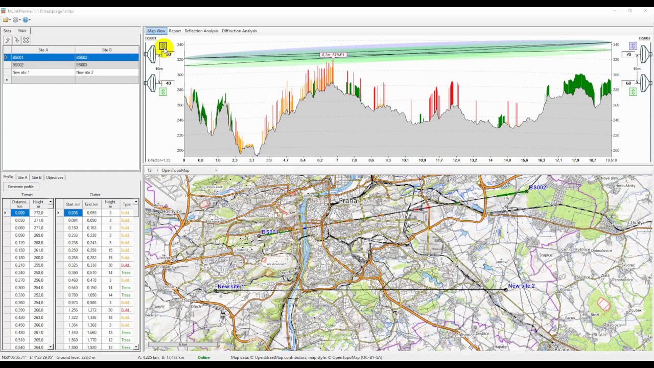
MLinkPlanner is all-in-one software for microwave point to point link planning:
Great GIS Features:
Fully automatic generation of path profile with terrain elevation, tree height and height of buildings based on:
- global terrain elevation 1 arc sec resolution
– global tree cover 1 arc sec resolution data with information about trees height.
– global 3D buildings data from OpenStreetMap project database.
All these types of geodata are downloaded to the desired area automatically as needed, there is no need to worry about preloading the geodata. Moreover, you can edit an existing or create a new path profile manually.
The application allow use any kinds of basemaps—both common (such as OpenStreetMap, OpenTopoMap, etc.) and custom ones.
Full-Featured Path Profile Analysis:
– Automatic antenna height optimization – evaluate clearance criteria according Rec. ITU-R P.530-16
– Reflection Analysis (Rec. ITU-R P.530-16)
– Diffraction loss analysis (Rec. ITU-R P.526-13)
Accurate Link Performance Analysis:
– Multipath fade probability calculation (Rec. ITU-R P.530-16)
– Rain fading calculation (Rec. ITU-R P.530-16)
– Error performance and availability calculation (Rec. ITU-R F.1668, Rec. ITU-R F.1703)
Appropriate Quality and Availability Objectives:
– Performance objectives based on ITU-R F.1668, Rec. ITU-R F.1703 recommendations
Support for any Equipment Configuration:
– Adaptive modulation
– Frequency, space and quad diversity
– Cochaneel operation link calculation
– Support for ASCII radio data file format *.raf used in Pathloss 5
Flexible Report
– Short and full report
– Report with integrated graphics – map and path profile
– Report can be sent to the printer, or saved in the formats Pdf, Microsoft Word or Excel
atoll logiciel